

NSDC Approved GIS Remote Sensing Course India

You are kindly requested to fill out this form and select the course at IIIC that interests you so that we may get in touch with you as soon as admissions are open.
Choosing the right GIS remote sensing course in India can shape an entire career in infrastructure planning. Geographic Information Systems and remote sensing now drive land surveying, urban planning, and project mapping across Kerala and the rest of the country. Fresh Civil and Geoinformatics graduates, along with government and PSU technical staff, need practical, government recognised training to stay relevant. This guide explains what GIS and remote sensing involve in infrastructure work, how IIIC’s Advanced Diploma in GIS program builds these skills, and why NSDC approval matters for credential recognition, RPL pathways, and government hiring.
Key Takeaways
- GIS and remote sensing skills support land surveying, urban planning, and infrastructure mapping projects across India.
- IIIC’s NSDC courses Kerala portfolio includes the AD GIS program, built on 75 percent practical, hands on training.
- NSDC recognition supports RPL pathways, credential trust, and eligibility for government and PSU technical roles.
What Is GIS and Remote Sensing in Infrastructure Projects
Geographic Information Systems and remote sensing combine satellite imagery, drone data, and mapping software to plan and monitor infrastructure projects. Engineers and planners use these tools for land surveying, utility mapping, and disaster response. Understanding this technology is now a core requirement for civil, geoinformatics, and infrastructure professionals working on government and private projects across India.
GIS and remote sensing technology captures spatial data through satellites, drones, and ground survey instruments. This data becomes digital maps that support road alignment, utility networks, and land use planning. Infrastructure teams rely on this information to reduce errors before construction begins.
Kerala’s terrain, with its backwaters, hill regions, and dense urban corridors, makes accurate spatial data especially valuable. Government agencies use platforms such as ISRO’s Bhuvan geoportal for satellite imagery and terrain analysis. Trained GIS professionals interpret this data to support planning, disaster management, and asset monitoring for public infrastructure. As India expands highway, rail, and urban development programs, demand for skilled GIS and remote sensing professionals continues to grow steadily across government and private sectors.
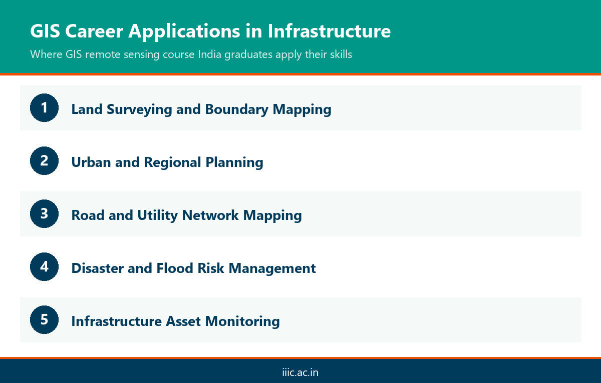
Common applications include land parcel mapping for revenue departments, utility network tracking for water and power boards, and terrain modelling for hill road projects. Remote sensing also supports flood and landslide risk mapping, which matters for a state prone to monsoon disruption. Professionals who can read satellite and drone data accurately add direct value to project planning teams from the earliest design stage.
IIIC’s Advanced Diploma in GIS Program
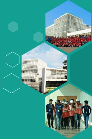
IIIC’s Advanced Diploma in GIS (AD GIS) program trains graduates in mapping software, drone based survey techniques, and spatial data analysis. The course follows an NSQF aligned, NSDC certified curriculum with 75 percent practical training on IIIC’s Kollam campus. Graduates gain hands on experience with real infrastructure survey projects.
The AD GIS program at IIIC is built for fresh Civil and Geoinformatics graduates who want a practical, industry recognised GIS remote sensing course in India. Students work with GNSS survey equipment, drone mapping tools, and GIS software used across real infrastructure projects.
Training includes field survey exercises on IIIC’s 9 acre Kollam campus, guided by faculty with industry experience. The program aligns with National Skill Development Corporation standards, giving graduates a credential recognised by employers and government departments. Students also gain exposure to CSDCI and IESC aligned skill benchmarks, preparing them for roles in survey, planning, and GIS based infrastructure teams.
Coursework covers satellite image interpretation, GIS software workflows, and drone flight operations for mapping projects. Learners also complete supervised field assignments that mirror real project briefs from infrastructure and survey clients. This applied structure helps graduates move directly into technical roles without a lengthy on the job learning curve after placement.
What NSDC Approval Means and Why It Matters
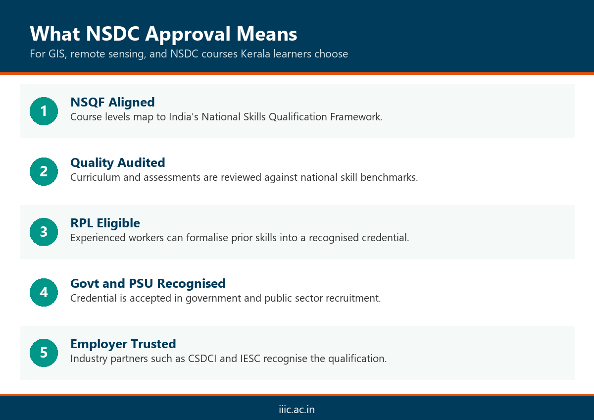
NSDC approval means a course meets national skill standards set by the National Skill Development Corporation, a government body under India’s skill development mission. For learners, this recognition affects credential trust, RPL eligibility, and hiring preference in government and PSU technical roles across infrastructure and construction sectors.
NSDC approved courses follow NSQF levels, standardised assessments, and quality benchmarks. This matters because many public sector employers and RPL processes require government recognised training. Without this recognition, credentials may not count toward formal skill certification.
For working professionals and RPL candidates, NSDC alignment provides a documented path to formal qualification based on prior experience. IIIC’s programs are certified against these standards through National Skill Development Corporation and partner bodies such as CSDCI and IESC. This gives graduates confidence that their GIS and remote sensing training, and other technical qualifications from IIIC, will be recognised across India’s construction and infrastructure hiring landscape, not just within Kerala.
Among IIIC’s NSDC courses Kerala learners can choose from, GIS sits alongside programs in BIM, quantity surveying, and site supervision, all assessed against the same national framework. This consistency matters for employers who screen candidates by NSQF level rather than institution name alone. It also matters for government tenders and PSU recruitment, where NSDC certification is often listed as a preferred or mandatory qualification criterion.
Adjacent NSDC-Aligned Skill Areas Including Contracts Management
GIS and remote sensing rarely work in isolation on infrastructure projects. Adjacent NSDC aligned skills, including quantity surveying and contracts management, support the same project lifecycle from planning through execution. IIIC offers a dedicated contracts management course construction professionals can pair with GIS training or pursue independently for broader project roles.
Infrastructure projects depend on coordinated skills beyond mapping alone. Quantity surveying and contract administration determine costs, timelines, and compliance once GIS data informs the initial planning stage.
IIIC’s Advanced Diploma in Quantity Surveying and Contracts Management (AD QSCM) trains graduates in tendering, cost estimation, and contract documentation for construction projects. Civil graduates often combine GIS skills with contracts management training to strengthen their profile for project management and site coordination roles. Both programs share the same NSDC aligned, practical training model, so learners can browse IIIC’s full course catalog to plan a combined study path across technical and commercial infrastructure roles.
A contracts management course construction focused graduate completes typically covers tender documentation, quantity take offs, and cost control on live project data. Pairing this with GIS training gives a candidate visibility into a project from spatial planning through financial execution. Employers increasingly value this combined skill set for site engineer and assistant project manager roles across Kerala’s infrastructure and construction sector.
Career Outcomes for GIS and Remote Sensing Graduates
Graduates of NSDC approved GIS remote sensing courses in India find roles in land surveying, urban planning, disaster management, and infrastructure asset mapping. IIIC’s placement support connects trained candidates with government departments, PSUs, and private infrastructure firms across Kerala and other states seeking certified GIS talent.
GIS and remote sensing skills open roles across survey teams, planning departments, and infrastructure consultancies. Graduates work on road and rail alignment, utility mapping, environmental assessment, and disaster response projects.
Government and PSU technical roles increasingly require NSDC recognised credentials during recruitment and promotion. IIIC’s placement support and industry partnerships with NSDC, CSDCI, and RICS India help graduates connect with employers actively hiring GIS trained talent. Many graduates also progress into supervisory or project coordination roles by combining GIS training with adjacent skills such as contracts management or road construction planning.
Entry level GIS analysts typically start on survey or mapping desks before moving into planning or field supervision roles within two to three years. Government and PSU recruitment cycles in Kerala and neighbouring states regularly list GIS and remote sensing skills alongside civil engineering qualifications. A government recognised credential from an NSDC aligned institute gives candidates a measurable edge during shortlisting and technical interviews.
Conclusion
Choosing a government recognised GIS remote sensing course in India gives graduates and technical staff a credible, practical path into infrastructure careers. IIIC’s NSDC approved AD GIS program combines hands on training, industry aligned curriculum, and placement support on a dedicated Kollam campus. Whether you are a fresh Civil or Geoinformatics graduate, or a government or PSU professional upskilling for project roles, this credential builds skills employers trust. Explore IIIC’s AD GIS program today and take the next step toward a recognised, employment focused qualification in GIS and remote sensing.
Frequently Asked Questions
What is a GIS remote sensing course in India used for?
A GIS remote sensing course in India trains students to capture, analyse, and interpret spatial data using satellites, drones, and mapping software. Graduates apply these skills in land surveying, urban planning, infrastructure mapping, and disaster management across government and private projects.
What does NSDC approval mean for a training program?
NSDC approval means the National Skill Development Corporation has verified a course against national skill standards and NSQF levels. This recognition supports RPL pathways, credential trust, and eligibility for government and PSU technical hiring across India.
Who is eligible for IIIC’s AD GIS program?
IIIC’s AD GIS program is designed for fresh Civil Engineering, Geoinformatics, and related diploma or degree graduates. Working professionals seeking GIS upskilling can also apply, subject to IIIC’s current admission and qualification criteria each intake.
How long does the AD GIS program take to complete?
IIIC’s Advanced Diploma programs combine classroom instruction with extensive practical training over several months, following an NSQF aligned structure. Exact duration and intake details are confirmed during admission counselling, since batch schedules vary by program.
Does IIIC provide placement support after GIS training?
Yes. IIIC offers placement support through industry partnerships with NSDC, CSDCI, IESC, and RICS India. Graduates receive guidance connecting them with government departments, PSUs, and private infrastructure employers seeking certified GIS and remote sensing survey talent.
How is a GIS course different from a CAD or surveying course?
GIS focuses on spatial data analysis, mapping layers, and satellite or drone imagery, while CAD emphasises technical drawing and design. Surveying collects ground level measurements. GIS training often combines all three for complete infrastructure project support.
Can RPL workers get NSDC recognition through IIIC?
Yes. IIIC supports Recognition of Prior Learning for experienced construction and infrastructure workers. RPL candidates can formalise existing skills against NSDC and NSQF benchmarks, gaining a government recognised credential without repeating full time classroom coursework.
What career roles are available after a GIS and remote sensing course?
Graduates work as GIS analysts, survey engineers, mapping technicians, and infrastructure planning assistants. Roles span government departments, PSUs, and private construction or urban planning firms across Kerala and other Indian states hiring skilled technical talent.
What other NSDC-aligned courses complement GIS training at IIIC?
IIIC offers adjacent NSDC aligned programs, including quantity surveying, contracts management, and road construction management. Pairing GIS skills with a program like AD QSCM strengthens a graduate’s overall project management profile and long term career flexibility.
How does GIS training support road and infrastructure planning careers?
GIS and survey skills feed directly into road and infrastructure project planning, from initial mapping through construction monitoring. Programs such as IIIC’s Postgraduate Diploma in Road Construction Management build on this foundation for project level planning and site supervision roles.